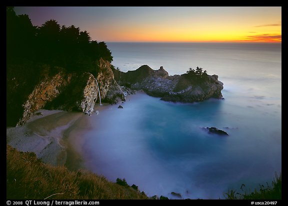
The Location and Physical Setting of Big Sur reminds me of Hawaii...
Hawaii is in the middle of the Pacific Ocean , while Big Sur is on the Coast
Hawaii and Big Sur's locations are both relatively isolated
Hawaii's geology shows visible volcanoes and Big Sur's geology
includes some of the most abrupt elevation changes on the entire Pacific Coastline.
McWay Falls at Pfeiffer Beach in Big Sur, CA reminds me of Hawaiian Paradise...

Big Sur Geology
 The mountains of the rugged Big Sur coastline rise to 5,000 foot summits within two miles of the ocean, the most abrupt elevation change of the entire Pacific shore.
Several hundred million years ago, river-borne sediments from a mountain range in what is now Mexico were deposited along the western coast. These layers of sandstone, siltstone and limestone were compressed and folded by the underriding of tectonic plates at the continent's edge. The sediments metamorphosed with pressure into schist, gneiss, granofels and marbles--now the oldest rocks in the Santa Lucia range.

By sixty five million years ago, this plate -- called the Salinan block -- began to drift northward. In response to the clockwise rotation of the Pacific Ocean's crust, the block was temporarily halted in its smooth progress and became jostled with faulting and uplifting, a process that still continues today. Seismic activity along the many faults is common as the mountains continue to be uplifed. Stream canyons frequently follow fault lines. Lateral faults are in the majority here, hence, most canyons parallel the coast rather than descend directly to it.
The highest peaks visible are granitic rock, which tends to be more resistant to erosion. In places where stream erosion was minor, the taller peaks may also be marble (metamorphosed limestone)--Pico Blanco is one such marble summit. The original sediments of sandstone and siltstone have been tilted up into cliffs in some areas. The sculpted shapes at Point Lobos are rare local examples of conglomerate formations.
Source: http://www.bigsur-coastline.com/geology.html
Pfeiffer Beach at Sunset...

Source: http://www.terragalleria.com/california/picture.usca20497.html
Morro Rock is one of a line of ancient volcanic intrusions or plugs sometimes called the Seven Sisters or The Nine Morros, depending on how many of the peaks are included in the count.
Morro Rock, Morro Bay CA near Big Sur

Source: http://patricksmithphotography.smugmug.com/Landscapes/California-Big-Sur-South/14079881_GcJrg
Evidence supports a theory that the morros erupted along old fault lines, leading to a hot spot deep within the earth. Morro Rock is dated to about 22 million years old. Black Hill, rising behind the Morro Bay Golf Course, and Hollister Peak are about 28 million years old during the Oligocene epoch of geologic history. The Morros may have formed south of the region with their remnants moving along the San Andreas fault to their current positions.
Many other changes took place over the millions of years since Morro Rock solidified. About eighteen to twenty thousand years ago, the sea was 300 feet lower than it is today. Morro Rock stood on dry land. After the last glacial retreat, the sea rose again and Morro Rock was surrounded by salt water. A causeway to Morro Rock was made in 1933 through the Works Progress Administration. A causeway was created with materials blasted from the rock.
The volcanic plugs tend to have steep sides of exposed rock, although buttresses slope from these peaks to make all of them accessible. The Chorro Valley surrounds the Morros and features several hundred Chumash Indian mortar sites. If you would like to learn more about the history and geology of Morro Rock and other morros, visit the Morro Bay Museum of Natural History.
No comments:
Post a Comment